We resumed our walking on a unwisely-chosen day as the mist was down and we could barely see the beaches at the bottom of our cliffs. In some ways this was an advantage for we started in the middle of Newquay, eventually finding the end of the footbridge we had visited on our previous outing. It was hidden away in an anonymous and dull housing estate on the edge of Pentire where parking was positively discouraged.
Newquay is not famous for its architectural splendours. Sadly, many of its buildings are dull, cheap, functional, or have been rendered inelegant by the demands of business. Around its historic core, the town has sprawled with guest houses and businesses essaying a hard-to-believe jollity climbing over each other to attract customers.
The town was a late C19 speculative construct. A slump in usage of the rail line from Par for goods and a switch to passengers, helped the town to develop a tourism industry. Silvanus Trevail then worked out plans for a model resort – plans which were never fulfilled – and business took off. How unlike Portreath which also had a railway of sorts but was not connected to the main line and therefore never made the jump to a railway-borne tourist.

Trevail was responsible for the three great hotels which are the landmarks of the Newquay skyline and which would never be allowed today: indeed, in 1933 the CPRE apparently argued for their demolition. They could have put their efforts into spreading the indiscriminant sprawl of the town with its muddled and often low quality architecture.
The decline of the ‘English seaside holiday’ from the end of the 1960s could have been the final straw for Newquay’s 100 year-old tourism industry but the surfing industry has given it a new lease of life. Sadly, this has not brought high quality. In some ways, the result is a reminder of how ineffective our post-War planning laws really are: unable to prevent low quality sprawl and the voracious appetites of red-blooded commercialism.
 Walking through a town like Newquay was never going to be our ideal for a coast path but we were pleasantly surprised at some stretches. The route attempts to follow the coast through the town following a litany of famous beach names: Fistral, Tolcarne, Lusty Glaze and Porth.
In some parts one would not actually know you were in a town at all thanks to the golf course which kept buildings well back from the cliff edge or because the path was below the cliff edge itself. The cliffs and beaches themselves were indeed spectacular, as far as we could see them.
It was very early in the season but fun and games were clearly starting: coasteering, surfing and setting up for a beach festival of some sort. Whoops of glee came through the mist from the participants.
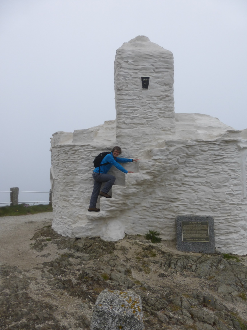
We were pleased to greet the huer’s hut but were unable to take advantage of its telescope which promised a 10x magnification of the view – of the mist.
These thoughts occupied us as we tramped past restaurants offering Indian, Portuguese, Greek, Turkish and Australian fare. It is 90 minutes of the coast path that have to be endured. Signage through the town was very patchy with stickers on posts being almost the best on offer.
It was a relief to reach the open spaces beyond Porth and Trevelgue Head, noting its mighty Iron Age fort in passing, where the town ends abruptly and the great expanse of Watergate Bay (allegedly thanks to the mist) stretches out northwards.
 A long classic cliff-top stretch follows with the geology gradually changing to a shale or slate.
Passing Watergate Bay hotel we noted the new development of modern chalets crouched into a narrow valley. At least this architect had been prepared to think through the landscaping and materials, covering the roofs in grass. Serried ranks perhaps but preferable to anything we had seen so far.
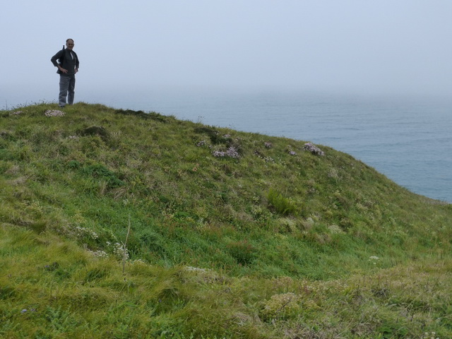
The arrival of Griffin Head gave us some satisfaction and we explored the remains of the ramparts of a small Iron Age fort which was not on the same scale as that at Porth.
Mawgan Porth appeared through the mist, its mighty beach empty of water at low tide and we returned to our waiting car.
8.5 miles in about three hours of walking left us wanting more but next time we will do it in bright sunshine.
Visits to St Mawgan and St Columb churches completed our day out.

One thought on “The Gannel to Mawgan Porth”
Comments are closed.